
The Flood Early Warning product provides a twice daily global forecast for where floods are likely to occur, and their severity in the following four days. The product is derived from global weather models, global river flood forecasts, flood propensity maps and ICEYE’s own historical observations of flooding. The product currently supports flood and location and timing prediction of large scale pluvial and fluvial (riverine) flooding. For each prediction of location and time, estimated impact is provided in qualitative terms for five impact categories. In select geographies, higher resolution flood hazard zones are provided within forecast flood regions to
enhance users judge risk of flooding to their locations of interest.
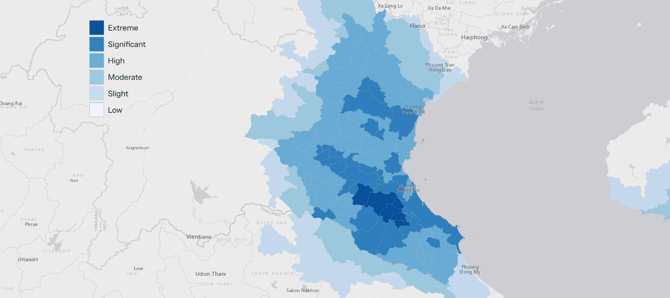
ICEYE Flood Early Warning Elements
| Flood Alert Points Vector points indicating administrative areas at particularly high risk of flooding. | -> Alert level is defined as the Flood Forecast Grid reaching levels of “Significant” flood risk or higher. |
| Watershed Flood Risk Vector file indicating the watersheds at risk of flooding (Hydrobasin level-8) |
-> Each watershed is attributed with a ICEYE FEW Score, which corresponds with a qualitative explanation of expected flood severity for the watershed. -> The FEW score is an aggregation of the underlying Flood Forecast Grid, serving to indicate the region most at risk of flood given the underlying factors. -> The severity legend is consistent with the Flood Forecast Grid layer. |
| Flood Forecast Grid Raster indicating severity of flooding within 1km x 1km grid cells |
-> The raster file is provided to alert users of areas that are at particularly high risk within the watershed. -> There is inherent uncertainty associated with granular predictions, so the 1km x 1km layer should be used in support of other sources of information when making decisions. |
| High Resolution Flood Hazard Zone 50m Resolution riverine flood hazard layer overlaid inside the predicted watershed polygon. Three severity levels are presented so that users can judge risk to their portfolio for a forecast event. |
-> Available in England, Wales and Scotland -> Severity levels provided: -> This layer is provided within specific forecast watersheds and available separately as a Static Layer to visualize the layer all at once. |