
Flood Solutions in ISS
Events dating back to October 2022 are available but some older events may not have the same functionality as newer events e.g. data downloading or visualization.
Events in a Monitoring state are those where flooding is forecasted but has not yet occurred, or where flooding has started and ICEYE is collecting and reviewing data to determine if the analysis threshold for Flood Insights has been surpassed.
For these events, the area that ICEYE is monitoring for flooding is shown on the map and the left-hand panel has a description of the flood event as well as an estimated time range of flooding for the area.
Both the monitoring area and the details will be updated as the event progresses.
An event in Monitoring status will not have Flood Insights data available, but it may have Flood Rapid Impact (FRI) data available.
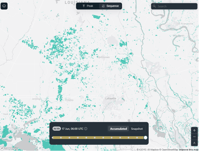
FRI visualization is split between the Peak and Sequence tabs in the map viewer. The peak view shows the latest Accumulated Extent and the Sequence view brings up a time slider allowing you to scrub through the history of both the Accumulated Extent and the Snapshot Extent.
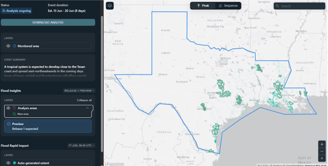
Events in an Analysis ongoing state are those that ICEYE is actively analyzing and producing Flood Insights outputs. This stage lasts from the time that the analysis threshold is passed to when the flooding stops and ICEYE no longer sees evidence showing new flooding. If there is a draft release of Flood Insights ready for preview, you can preview the upcoming analysis areas by selecting the upcoming release from the release dropdown above the layer selector.
Once ICEYE has exhausted evidence of flooding the event will move to the Analysis done status.